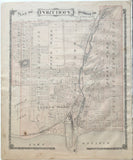
Scale 10 Chains to 1 inch
16" x 13" (40.6 x 33 cm)
original antique map (some stains & spotting, couple short tears to lower margin).
from Illustrated Historical Atlas of the Counties of Northumberland and Durham Ontario, Toronto: H. Belden & Co., 1878.
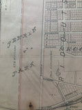
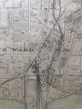
Landmarks include: Penryn Park, Agricultural Park, Union School, a church, Market Square, several mills, a station depot, a lighthouse, Smith's Creek,
Landowners include: Charles Seymour's Estate, Arthur T.H. Williams, W.T. Mitchell, W.M. Moulson, Thomas Moulson's Estate, Nathan Choate.
own a piece of Ontario Local History & Genealogy
Go back in time and trace the history of the Ontario & it's ancestors and maybe even your own!
John Tucker Williams, founder of the Williams family, came to Canada during the War of 1812. He finally settled at Port Hope and built a home calling it Penryn, after his ancestral home in Cornwall. During the Rebellion of 1837 he commanded the Durham Regiment; later represented the County in Parliament and was the first Mayor of Port Hope. His eldest son Arthur T.H. Williams is shown as a property owner at this time, which was only 4 years prior to his death after The Battle of Batoche during the North West Rebellion of 1885. His sister Emma Williams married Benjamin Seymour's only son Charles Seymour who is also shown on this map as a landowner
~If you're looking for a particular town, city, township or county please contact us and we will let you know what we have.
*Map will be mailed flat and not in a tube. Please contact us if you would prefer to have it rolled
**Custom Framing available! Please contact us for details.


