Scale 9 Chains per Inch
12" x 15 1/2" (30.5 x 39.4 cm)
Sheet measures: 14 3/4" x 17 1/2"
original antique map (upper corner creased, some offsetting, two short tears to margins and one tear to lower left edge with repair).
from The Historical Atlas of the Counties of Hastings and Prince Edward Counties, Toronto: H. Belden & Co., 1878.
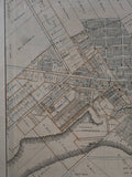
Landmarks include: Bay of Quinte, Picton Harbour, Picton Driving Park Association, Agricultural Society, county buildings, court house, Bank of Montreal, a town hall, a market, Standard Bank of Canada, churches, a graveyard & street names.
Landowners include: E. Werden, W.H.R. Allison, W. Best, C.S. Wilson, W. Ross, T. Yarwood, Estate of Reverend William Macauley, G. Laird, P. Low, W. Owens, P. Washburn, J.F. Dougall, J. Spencer, C. Spencer, J. Johnson, D.J. Barker, J.W. Barker, Miss Washburn, M. Coleman, C.W. Ingram, D. Platt, A. Hoover, Mrs. Herrington, J. Thompson, D.A. Thomson, William Daily, F. Wycott, R. Burke, K. Collins, R. Corslin, R. Welsh, A. Southard, A. Meyers, William Reynolds, P. Hamill, James Hooper, Captain Downes & others
own a piece of Ontario Local History & Genealogy
Go back in time and trace the history of the Ontario & it's ancestors and maybe even your own!
~If you're looking for a particular town, city, township or county please contact us and we will let you know what we have.
*Map will be mailed flat and not in a tube. Please contact us if you would prefer to have it rolled
**Custom Framing available! Please contact us for details.

![H. Belden & Co. 1878 Antique Map of the Plan of Picton Ontario [Prince Edward County]](http://delakeltd.com/cdn/shop/products/IMG-6848_{width}x.jpg?v=1661529310)
![1878 Antique Map of the Plan of Picton, Ontario H. Belden & Co. Map [Prince Edward County, Southern Ontario]](http://delakeltd.com/cdn/shop/products/IMG-6854_1_{width}x.jpg?v=1661529310)
![1878 Antique Map of the Plan of Picton, Ontario H. Belden & Co. Map [Prince Edward County, Southern Ontario]](http://delakeltd.com/cdn/shop/products/IMG-6851_{width}x.jpg?v=1661529310)
![1878 Antique Map of the Plan of Picton, Ontario H. Belden & Co. Map [Prince Edward County Old Map]](http://delakeltd.com/cdn/shop/products/IMG-6853_{width}x.jpg?v=1661529306)

![H. Belden & Co. 1878 Antique Map of the Plan of Picton Ontario [Prince Edward County Map]](http://delakeltd.com/cdn/shop/products/IMG-6850_{width}x.jpg?v=1661529306)
![H. Belden & Co. 1878 Antique Map of the Plan of Picton Ontario [Prince Edward County]](http://delakeltd.com/cdn/shop/products/IMG-6848_compact.jpg?v=1661529310)
![1878 Antique Map of the Plan of Picton, Ontario H. Belden & Co. Map [Prince Edward County, Southern Ontario]](http://delakeltd.com/cdn/shop/products/IMG-6854_1_compact.jpg?v=1661529310)
![1878 Antique Map of the Plan of Picton, Ontario H. Belden & Co. Map [Prince Edward County, Southern Ontario]](http://delakeltd.com/cdn/shop/products/IMG-6851_compact.jpg?v=1661529310)
![1878 Antique Map of the Plan of Picton, Ontario H. Belden & Co. Map [Prince Edward County Old Map]](http://delakeltd.com/cdn/shop/products/IMG-6853_compact.jpg?v=1661529306)

![H. Belden & Co. 1878 Antique Map of the Plan of Picton Ontario [Prince Edward County Map]](http://delakeltd.com/cdn/shop/products/IMG-6850_compact.jpg?v=1661529306)