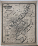
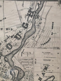
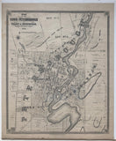
Original Antique Map of The Town of Peterborough and Village of Ashburnham 1878 [South-Central Ontario]
19 1/4 x 16 inches (48.7 x 40.7 cm)
sheet measures: 21" x 17 1/2"
original 1878 antique map (some spotting & soiling, 2 short tears to bottom margin, 1 small abrasion).
from The New Topographical Atlas of The Province of Ontario. Toronto: Miles & Co., 1879. Lithograph by The Burland Dessarats Lith. Co., Montreal.
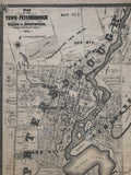
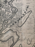
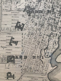
Landmarks include: Township of Douro, Armour's Hill, Bellevue Park, Little Lake, Otonabee River, Little Lake Cemetery, Market Square, Old Chemong Railway, Coburg & Peterborough Railway, Giles' Nursery, Clonsilla Hill, Iverlea, Court House, churches, schools, mills and street names.
Some landowners include: Rev. Mark Burnham, J. D. Armour, Judge Dennistoun, George Hilliard, James Edwards, E. Chamberlain, P. Hamilton J.Z. Rogers, C.D. Baker, James Campbell, Elias Burnham, James Hall, George A. Cox, Rev. J.M. Rogers, Andrew Kane, C.J. Blomfield, Dickson Estate, W. Lundy, McFarlane Estate, William Hein, J. Corkery, William Hall, Robert Brown, M. Tagney, Hay Estate, R.A. Morrow, A.H. Campbell and others.
Go back in time and trace the history and growth of Ontario!
own a piece of Ontario Local History
~If you're looking for a particular town, city, township or county please contact us and we will let you know what we have.
*Map will be mailed flat and not in a tube. Please contact us if you would prefer to have it rolled
**Custom Framing available! Please contact us for details.


