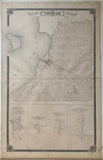
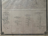
1877 Antique Map of Thorah Township & villages of Cedar Dale, Harmony, Raglan & Columbus [Ontario County / now Durham Region, Central Ontario]
25 x 15 1/2 inches (63.5 x 39.3 cm)
sheet measures: 27 1/4" x 17 1/2"
original antique map (staining to margins & outer edges, light spotting along centerfold).
from the Illustrated Historical Atlas of the County of Ontario, Toronto: J.H. Beers, 1877.
Towns & Villages: Beaverton, Gamebridge, Cedar Dale, Harmony, Reglan & Columbus
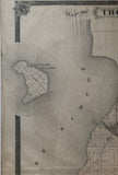
Landmarks include: Lake Simcoe, Thorah Island, Talbot River, Beaver River, Cedar Dale Pond, Cedar Dale Works, Midland Railroad, schools, cemeteries,churches and some street names.
Some landowners include: T. Conant, G.P. Chandler, W. Coleman, R.S. Hamilton, J. MacEwan, C. Campbell, Jas. Donnell, Neil MacEachren, William MacRae, Alex MacRae, G.R. Proctor, R. MacDougall, A. Muir, J. Grant, J. Ross, L. Johnston, William Oke, D. MacRae, J. Ceale, William Francis, Miss Sophia Turner, R, Calder, William Brain Sr. Arch Currie, T. Metcalf, G. Grant, A. Edgar, N. & A. Buchanan, Don Ross, J. Adamson, A. Stoddart, William Daly, G.G. Glover, J. Howell, M. McTaggart, John MacLean, D. Gillespie, H. Morrison, R. Morrison, A. MacFadgen, Hugh MacMillian, J. MacInnis, C Spencer. J. McKay,, A. Mackay, A. MacCall, P. Walls, Alex Calder, A. Murray, J, Furnass, H. Hodson, D. Calder, W. White, T. Treleaven, Alexander Hamilton, L Miller, G. Procotor,, D. Cameron, D. Carmichael, James French, D. Graham, C. Galloway, J. Gunn, Don Gunn, A. Currie, A. Gillis, G. Evans, Mrs. R. Bethune, J.A. Proctor, T. Thompson, C.H. Davidson, R. Bruce, William Munro. William Fraser, K. H. Parliament, Canada Co., W. McArthur, Hector Grant, C Heron, Hanes Grant, T. Montgomery, Farquhar MacRae, M. Parks, L. MacNeil, D. Bruce, M. Brennan, E. Westott, C. Westcott, R. Hodgson, J. Dorcharly Estate and more.
Go back in time and trace the history of the Ontario & it's ancestors and maybe even your own!
own a piece of Ontario Local History & Genealogy
Donald Cameron also appears on the map, who in 1824 brought a number of settlers from Glengarry amongst them were the Campbells, The McRaes (MacRaes), the McDonalds (MacDonalds) and Camerons. Donald Cameron was also one Beaverton's first councillors.
~If you're looking for a particular town, city, township or county please contact us and we will let you know what we have.
*Map will be mailed flat and not in a tube. Please contact us if you would prefer to have it rolled
**Custom Framing available! Please contact us for details.


