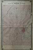
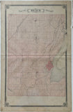
1877 Antique Map of Reach Township [Ontario County / Durham Region, Central Ontario]
25 x 15 1/2 inches (63.9 x 39.8 cm)
sheet measures: 27 1/4" x 17 1/2"
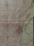
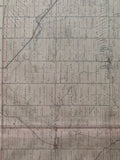
original antique map (some soiling & spotting, couple short tears and chips to margins - majority found along the right margin).
from the Illustrated Historical Atlas of the County of Ontario, Toronto: J.H. Beers, 1877.
Towns & Villages: Utica, Manchester, Port Perry, Epsom, Strattonville, Greenbank, Seagrave, Saintfield, Victoria Corners.
Landmarks include: Chalk Lake, Brock Road, Lake Scugog, Fairbanks Estate, mills, churches, cemeteries, schools, hotels, Laziers Factory, Nonquon River, Beaver Creek, farms, Orange Hall, cheese factory, mills, Simcoe Street, Whitby, Port Perry & Lindsay Railroad & the Toronto-Nipissing Railway.
Some landowners include: Thomas Choates, Harrison Vernon, Robert Bryant, William J. Brown. G.J. Hubertus, Thomas Boynton, Thomas Valentyne, MG. Robson, Kohn Holtby, William Pernill, Alex Graham, A.W. Ewers, Rev. John Mitchell, John Tennyson, William Crozier, Adam Earchman, Timothy Monroe, J. Leask, A. Leask, E. Williams, J.B. Laziers, Chas Roger, R. Lund, Mrs. Pound, Donald Christie, William Dewey, Crandall Estate, Reuben Crandall, Caleb Crandall, Edward Major, John Jeffrey, C. Marsh, Aaron Ross, Joseph Bowles, Richard Watson, T.D. Croxall, Robert Dobson, John Real, Joseph Lee, T.W. Forman, J. Bagshaw, Joseph Ward, Francis Mooney, Albert Orchard, William Rattenburg, George O'Leary, Robert Acton, A. Brethour, George St. John, William Randle, John Greg, Jas, Allen, G.J. Ward, Francis Ward, Jas. Baird, William Scott, Donald McKay, A & S. Bagshaw, G. Wallace, R. Pickle, Benj. Pickle, Charles Black, Benjamin Tripp, Donald Stewart.
Go back in time and trace the history of the Ontario & it's ancestors and maybe even your own!
own a piece of Ontario Local History & Genealogy
~If you're looking for a particular town, city, township or county please contact us and we will let you know what we have.
*Map will be mailed flat and not in a tube. Please contact us if you would prefer to have it rolled
**Custom Framing available! Please contact us for details.


