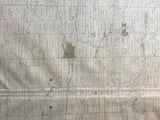
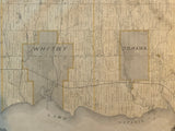
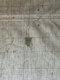
Antique Map of Whitby & East Whitby [Ontario County / Durham Region, Southern Ontario]
24 1/2" x 15" (62.7 x 38.1 cm)
antique map (few short tears to margins, crease to lower right, margins spotted and stained, few small stains near centre).
from the Illustrated Historical Atlas of the County of Ontario, Toronto: 1877.
Towns, Villages & Post offices include: Whitby, Oshawa, Brooklin, Ashburn, Myrtle, Raglan, Columbus, Foley, Harmony, Tauton.
Landmarks include: Lake Ontario, Grand Trunk Railway & Cedarville station, Whitby, Port Perry & Lindsay Railway, Light House, Port Oshawa, saw mills & grist mills; and schools & churches which are marked by buildings.
Landowners names and plots are marked. Some include: George McGillvray, Mrs. Tweedie, Tweedie Bro., Gibbs & Bro., L.C. Hall, T. Conant, T. Guy, J. Foley, J. Wilson, L. Grass, G.H. Grierson, T. Conlin, J. Drew, J. Hepburn, Dr. Closson and others.
Some families held substantial land at this time and several last names pop up over and over again on this map. Some Durham settlers prominently featured on this map include the DeLong family, Hall Family, Farwell Family, McGill family, Hyland Family Kerr Family. Gifford Family, Hill Family, Dyden Family and others.
Go back in time and trace the history of the Ontario & it's ancestors and maybe even your own!
own a piece of Ontario Local History & Genealogy
~If you're looking for a particular town, city, township or county please contact us and we will let you know what we have.
*Map will be mailed flat and not in a tube. Please contact us if you would prefer to have it rolled
**Custom Framing available! Please contact us for details.

![1877 Antique Map of Whitby & East Whitby [Durham County, Southern Ontario]](http://delakeltd.com/cdn/shop/products/IMG-6602_{width}x.jpg?v=1623688019)


![1877 Antique Map of Whitby & East Whitby [Durham County, Southern Ontario]](http://delakeltd.com/cdn/shop/products/IMG-6602_compact.jpg?v=1623688019)


