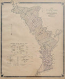
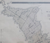
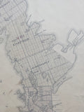
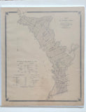
Antique Map of the Northern Townships of the Indian Peninsula County of Bruce 1879 [Bruce County, Southwestern Ontario]
Scale 240 chains to one inch
19 1/2 x 16 inches (49.5 x 41.1 cm)
sheet measures: 20 3/4" x 17 1/2"
Original antique map (some faint offsetting, couple short tears, light staining and spotting).
from The New Topographical Atlas of The Province of Ontario. Toronto: Miles & Co., 1879.
Townships include: St. Edmunds, Lindsay, Eastnor, Albemarle and Amabel
Towns & villages include: Stokes Bay, Hardwick, Lion's Head, Spry, Hope Bay, Pike Bay, Adair, Mar, Oliphant, Wiarton, Clavering, Hepworth, Sable River, Park Head, Skipness, Chippewa Hills, Southampton, Elisinore and Allenford.
Landmarks include: Tobermory Harbour, Cape Hurd, Georgian Bay, Lake Huron, Wingfield Basin, Cabots Head, Dyer Bay, Cape Chin, Isthmus Bay, Boat harbour, Pt. Hangcliffe or Lions Head, Barrow Bay, Stokes Bay, Lyal Island, Hope Bay, Sydney Bay, McGregor's Harbour, Colpoy's Bay, Sky Lake, Isaac Lake, Boat Lake, Fishing Islands, Indian Reserves, Chiefs Point, Sable River, Mill, Indian Village, schools and churches.
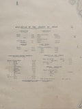
includes statistics of the County of Bruce.
Go back in time and trace the history of the Ontario & it's ancestors and maybe even your own!
own a piece of Ontario Local History & Genealogy
~If you're looking for a particular town, city, township or county please contact us and we will let you know what we have.
*Map will be mailed flat and not in a tube. Please contact us if you would prefer to have it rolled
**Custom Framing available! Please contact us for details.


