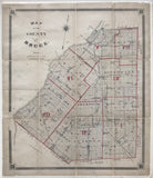
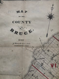
Antique Map of the County of Bruce c1880 [Bruce County, Southwestern Ontario]
Scale 2 miles to one inch
19 x 16 inches (48.5 x 41 cm)
sheet measures: 20 1/2" x 17 1/2"
Original antique map with original outline colour, mounted on linen in sections (lower left border professionally restored in facsimile; some tears, chips & spotting).
c.1880
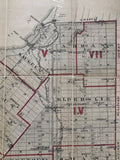
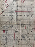
Townships include: Saugeen, Arran, Elderslie, Brant, Carrick, Bruce, Kincardine, Huron, Kinloss, Greenock & Culross.
Towns & villages include: Saugeen, Southampton, Port Elgin, Aberdour, Burgoyne, Elisinore, Dumblane, Queen Hill, North Bruce, Underwood, Gresham, Iverhuron, Tiverton, Eskdale, Glammis, Armow, Lorne, Kincardine, Bervie, Purple Grove, Lisburn, Dingwall, Pine River, Verdun, Amberley, Lurgan, Tara, Arkwright, Ivermay, Dobbinton, Williscroft, Carnegie, Gilles Hill, Paisley ,Chesley, Scone, Ellengowan, Vesta, Pinkerton, Eden Grove, Solway, Malcolm, Elmwood, Dunkeld, Walkerton, Maple Hill, Hanover, Carlsruhe, Formsa, Mildmay, Balaklava, Ambleside, Chepstowe, Riversdale, Greenock, Kinloss, Kinlough, Holyrood, Lucknow, Ulster, Langside, Moscow Village, Cheviot, Teeswater, Belmore.
Landmarks include: Lake Huron, Indian Village & Reserve, Bai Du Dore, Point Douglas, Point Clark, Eldersley Creek, Saugeen River, Tees Water Mud Creek, Durham Road, railway stations, the Wellington, Grey and Bruce Railway, churches and schools.


