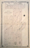
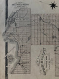
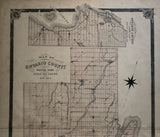
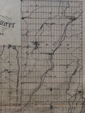
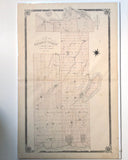
1877 Antique Map of Ontario County [Ontario County / Durham Region, South-Central Ontario]
25 x 15 inches (64 x 38.4 cm)
sheet measures: 27 1/4" x 17 1/2"
original antique map (some spotting and soiling, couple short tears to left margin).
from the Illustrated Historical Atlas of the County of Ontario, Toronto: J.H. Beers, 1877.
Townships include: Pickering, Whitby, East Whitby, Uxbridge, Reach, Scogog, Scott, Brock, Rama, Mara & Thorah.
Cities & post office include: Rouge Hill, Dunbarton, Duffin's Creek, Cherrywood, Whitevale, Green River, Brougham, Greenwood, Claremont, Balsam, Kinsal, Audley. Whitby, Brooklyn, Ashburn, Oshawa, Columbus, Raglan, Udora, Zephyr, Leaksdale, Sandford, Uxbridge, Goodwood, Glasgow, Altona, Glen Major, Wilfred, Derryville, Cannington, Vroomanton, Valentyne, Sunderland, Pinedale, Wick, Victoria Corners, Saint Field, Epsom, Seagrave, Port Perry, Utica, Manchester, Scugog, Rama, Long Ford Mills, Fawn, Rathburn, Seabright, Atherly, Upergrove, Brechin, Gamebridge, Beaverton, Thorah Island.
Landmarks include: Lake Ontario, Grand Trunk Railway, Port Perry & Lindsay Railway, Scugog Lake, Toronto & Nippising Railway, Duffins Creek, Nonquon River, Beaver River, Black River, Lake Couchicing, Lake St. John, Mud Lake, River Severn, Northern Railway, Midland Railway, Talbot River, Beaver Creek, Thorah Island, schools, churches & a townhall.
Go back in time and trace the history of the Ontario & it's ancestors and maybe even your own!
own a piece of Ontario Local History & Genealogy
~If you're looking for a particular town, city, township or county please contact us and we will let you know what we have.
*Map will be mailed flat and not in a tube. Please contact us if you would prefer to have it rolled
**Custom Framing available! Please contact us for details.


