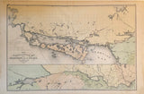
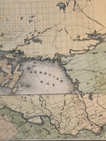
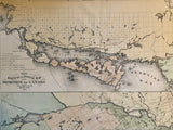
Size: 16 1/4" x 24 3/4" (41.4 x 62.9 cm)
original antique map (stains & a couple short tears to margins)
From Illustrated Historical Atlas of The County of York, Toronto: 1878.
General survey of the Railway & Postal Routes of Ontario during the Nineteenth Century. Covers the North part of the Lake Huron including Manitoulin Island & Thunder Bay district and portions of Nipissing district, Muskoka district, Algoma county & Renfrew County.
Landmarks include: Lake Nippissing, Nosbonsing Lake, Talon Lake, Matawin River, Ottawa River, Cedar Lake, Trout Lake, Petawawa River, Muskrat Lake, Sturgeon River, Manitoulin Island, Georgian Bay, Duck Island, Green Island, Drummond Island, Cockburn Island, St. Joseph Island, Falls of St. Mary, Batchewaung Bay, Desert Lake, Rock Lake, Bruce Mines, Serpent River, Spanish River, French River, Wallace Mine, White Fish River, Rat Lake, Round Lake, Byng Inlet, Lake Temagami, Huntsville, Mattawa, Petawawa, Pembroke, Hull, Ottawa, Thornby and more.
Go back in time and trace the history of the Ontario, and Railway & Postal Routes of Ontario during the Nineteenth Century
Own a piece of Ontario Local History
~If you're looking for a particular place please contact us and we will let you know what we have.
*Map will be mailed flat and not in a tube. Please contact us if you would prefer to have it rolled
**Custom Framing available! Please contact us for details.


