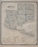
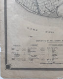
Scale 200 Chains to 1 Inch
21 x 17 3/4 inches (53.2 x 45 cm)
original antique map (some chips, tears & light spotting to margins, some creases to the left corners, small hole below Lake Erie).
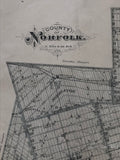
from The New Topographical Atlas of The Province of Ontario. Toronto: Miles & Co., 1879.
Includes: Middleton Township, Windham Township, Townsend Township, Houghton Township, Walsingham Township, Charlotteville Township and Woodhouse Township.
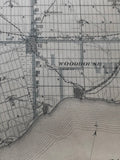
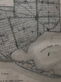
Landmarks include: Lake Erie, Long Point & Long Point Bay, Turkey Point Marsh, Great Western Railway Airline, Tilsonburg Station, Lake Huron & Port Dover Railway, Canada Southern Railway, Ronson P.O., Courtland P.O., South Middleton P.O., Delhi, Atherton P.O. Teeterville P.O. Windham Centre P.O., Lynnville P.O., Nixon P.O., Boston P.O., Kelvin P.O., Round Plains P.O., Waterford, Townsend Centre P.O., Villa Nova P.O., Bloomsburg P.O., Tyrrell P.O., Rockford P.O., Nobar P.O., Colborne, Renton, Lynn Valley, P.O., Port Dover, Port Ryerse, Hemlock P.O., Houghton P.O., Clear Creek, Glen Meyer P.O., Langton, Big Creek, Walsingham Centre, Spring Arbor P.O., Ship Canal, Port Royal, Port Rowan P.O. Lyndock P.O., Glenshee P.O., Silver Hill P.O., Walsh P.O., St. Williams P.O., Forestville P.O. Normandale P.O., Vittoria P.O. and others.
Includes statistics of the county.
Go back in time and trace the history and growth of Ontario!
own a piece of Ontario Local History
~If you're looking for a particular town, city, township or county please contact us and we will let you know what we have.
*Map will be mailed flat and not in a tube. Please contact us if you would prefer to have it rolled
**Custom Framing available! Please contact us for details.


