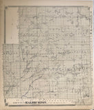
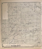
Scale 200 Chains to 1 Inch
20 6/8 x 17 6/8 inches (52.6 x 45.1 cm)
antique map (right margin closely trimmed, small tear to upper margin)
from The New Topographical Atlas of The Province of Ontario, Toronto: Miles & Co., 1879.
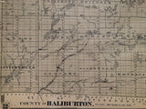
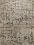
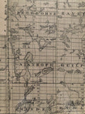
Lakes include: Trading Lake, Raven Lake Upper Fletcher Lake, Lower Fletcher Lake, Hollow Lake (Kawagama Lake), Round Lake (Livingston Lake), Kimball Lake, Lake Louisa, Welcome Lake, Rock Lake, St. Nora Lake, Kennisis Lake, Red Pine Lake, [Little Hawk Lake], [Big Hawk Lake], [Sherborne Lake], Halls Lake, Boshkung Lake, Twelve Mile Lake, Mountain Lake, Horseshoe Lake, Birch Lake, Gull River, South Lake, Kashagawigamog Lake, Soyers Lake, Beech Lake, Maple Lake, Grass Lake, Pine Lake, Cranberry Lake, Redstone Lake, Eagle Lake, Moose Lake, Oblong Lake, Haliburton Lake, Percy Lake, Kennibik Lake, Fishtail Lake, Madawaska Lake, Grace Lake, Farquhar Lake, Elephant Lake, Deer Lake, Paudash Lake, Otter Lake, Drag Lake, Long Lake, Burnt River, Moore Bay, Gull Lake, Miners Bay, Bob Lake, Beer Lake and others.
Post offices / towns marked: Moore Falls, Ontario; Peterson Corner, Eagle Lake, Carnarvon, Boshkung, Horseshoe bridge, Ingoldsby, Minden, Devils Creek, Snowdon, Eagle Lake, Haliburton, Gooderham, Kennaway, Cheddar and Paudash.
also includes A proposed railway line & Victoria Railway, Minden Station, Boyds Lumbering (Mossom Boyd), and an Iron mine.
This map covers much of Ontario's cottage country and the home of many Ontario Camps including Camp Kandalore on Lake Kabakwa, Camp Northland, Camp Timberlane to name a few!
Go back in time and trace the history and growth of Ontario!
own a piece of Ontario Local History
~If you're looking for a particular town, city, township or county please contact us and we will let you know what we have.
*Map will be mailed flat and not in a tube. Please contact us if you would prefer to have it rolled
**Custom Framing available! Please contact us for details.


